
Full Title: Landslide Mapping Using Lidar and Ortho Imagery in a GIS – Building Fundamental Mapping Skills for the Next Generation of Landslide Scientists
Endorsed by: GSA's Environmental and Engineering Geology, Geoinformatics and Data Science, Quaternary Geology and Geomorphology, Planetary Geology, Structural Geology and Tectonics, Environmental and Engineering Geology Divisions, American Association of State Geologists (AASG)
Industry tracks: Engineering Geology
Led by: Stephen L. Slaughter, William Burns, Matthew Crawford
Date: Sat. 18 Oct. 2025
Time: 8 a.m.-5 p.m.
Format: In-Person
CEUs: 0.8
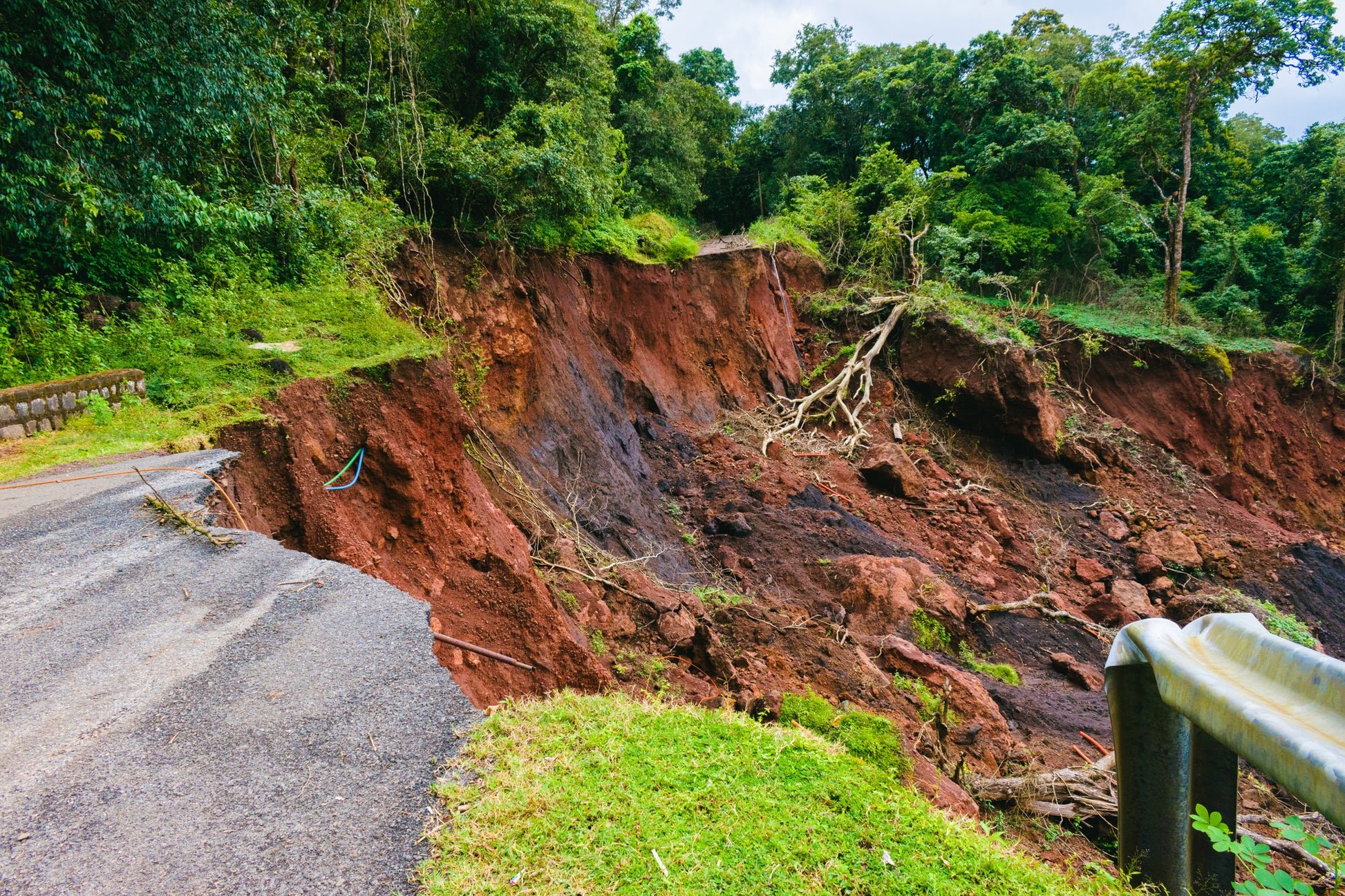
This short course will focus on the foundational elements necessary to build a landslide inventory from lidar and ortho imagery. Landslide inventories are a common tool used by planners, land managers, insurance companies, transportation departments, emergency managers, regulators, homeowners, geologic surveys, and others. The use of inventory maps by a variety of stakeholders makes detailed digitization of landslides an essential skill for a geoscientist. This short course aims to showcase the techniques and tools used to accurately and precisely map landslides using remote sensing tools in a GIS through demonstrations, discussion, and class exercises. We will also explore models used to build landslide hazard maps such as runout and susceptibility. ArcGIS skills and a laptop with an ArcGIS license are required, as is a fundamental understanding of landslides. This course is made possible due to a generous sponsorship from GSA's Environmental and Engineering Geology Division.
By purchasing this item, you are buying a seat for an in-person course.
Short courses offer continuing education units (CEUs). One CEU equals 10 hours of participation in an organized continuing education experience under responsible sponsorship, capable direction, and qualified instruction.
Learn more about this and other GSA Connects 2025 events.
For additional information, please contact Rebecca Taormina, rtaormina@geosociety.org, GSA Field Trip and Short Program Coordinator.
Product Code: SC25CN512
Product Category: SHORTC