

Compilers: Chelsea M. Feeney in collaboration with William M. Andrews
Available beginning at Connects 2026
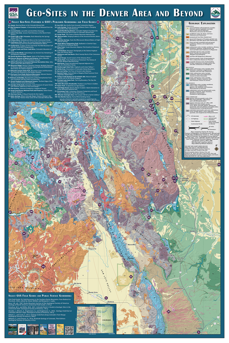
This colorful, two-sided map highlights geology and geologic themes in Denver, Colorado, USA, and beyond. The front of the map features a map of the Colorado Front Range showcasing geo-sites, including those featured in GSA Connects 2026 field trips and GSA
books. Flip to the back side and be inspired to explore Colorado geo-sites, learn about geoheritage, giving geoscientists and enthusiasts the ability to enjoy the geology of noteworthy field stops on their own and the Front Range, glimpse Colorado’s geodiversity
(San Juan Volcanic Field and the Colorado mineral belt), and view your own geologic time scale and correlation chart of Colorado.
This map will enrich your visit to Colorado and propel you to learn more about the Centennial State’s remarkable geology.
Published: Available beginning at Connects 2026
Dimensions: 36" long × 24" wide (folded, 2-sided sheet)
Product Code: MCH109F
Product Category: Maps & Charts
- Choosing a selection results in a full page refresh.
- Opens in a new window.